 View full size ↗
Know which lands the layer includes
MoMonuments draws Missouri public holdings from the USGS Protected Areas Database of the United States (PAD-US). This map uses fee-ownership records belonging to federal, state, local or regional public agencies.
The wider PAD-US inventory contains other categories too. The MoMonuments layer does not display private conservation holdings, conservation easements or broad proclamation boundaries as public fee ownership. It is not a complete property-parcel map.
| Category | Map appearance |
|---|---|
| Federal holdings | Forest green |
| Missouri state holdings | Teal |
| Local & regional holdings | Muted purple |
Inspect a holding beside your project
- 01
Open Map layers.
Public land boundaries starts on. Use Categories & legend to show or hide federal, state and local/regional holdings.
- 02
Zoom into the area.
Large holdings are visible in the overview; smaller tracts are easier to inspect closer in. Keep the PLSS context visible if it helps orient the project.
- 03
Select the polygon.
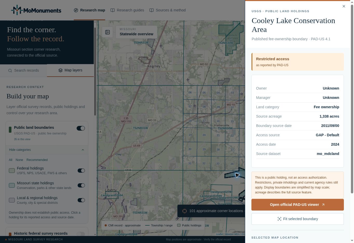
Click a highlighted holding to read the owner, manager, land category, source acreage, boundary source date and reported access.
- 04
Continue with the agency.
Use the official PAD-US viewer for broader inventory context, then check current conditions and entry requirements with the managing agency.
Read access separately from ownership
Owner or manager fields can also be unknown. Preserve that uncertainty and continue with the source agency; the map does not fill missing names by assumption.
The access badge reports the source classification: open, restricted, closed or unknown. It is not live confirmation that every entrance, road or part of a tract is open today. Look at the access source and date as well as the label.
An agency holding can contain restricted facilities or adjoin private inholdings. Neither a colored polygon nor a route to a selected coordinate grants access across intervening property. Make the necessary arrangements for the actual approach and work area.
Use the boundary for context
Display geometry is simplified according to map scale. The acreage in the panel describes the source feature, not a measurement of the visible clipped shape or the portion inside your project.
For boundary work, use the relevant title documents, surveys and field evidence. Treat PAD-US as an agency and land-context index. A gap in its coverage is not proof that the land is privately owned.
If the map reports Source unavailable, use Refresh visible layers. If it reports a limit or partial response, zoom closer or continue in the official viewer. Those statuses should stay in your research notes when they affect the completeness of a map capture.
Official sources
Continue with the agency responsible for the data or documents. Read MoMonuments data sources and methods for how these layers are used on the map.