
 View full size ↗
Choose the index for your research
Missouri provides the Land Survey Index (LSI) and Corner Master Index (CMI) as separate search applications. LSI includes recorded surveys, named subdivisions and historic references. CMI focuses on corner filings. The GLO plats and notes search is part of the LSI application, so the general LSI results can overlap records you see in Historic federal survey records.
| MoMonuments feature | Use it for |
|---|---|
| Corner record locations | Corner Master Index filings grouped at approximate corner research positions |
| Land Survey Index records | Broader survey documents indexed to a selected Missouri township |
| Historic federal survey records | GLO plats and field notes researched through BLM cadastral outlines and Missouri’s GLO index |
Turn on LSI and choose a township
- 01
Frame your research area.
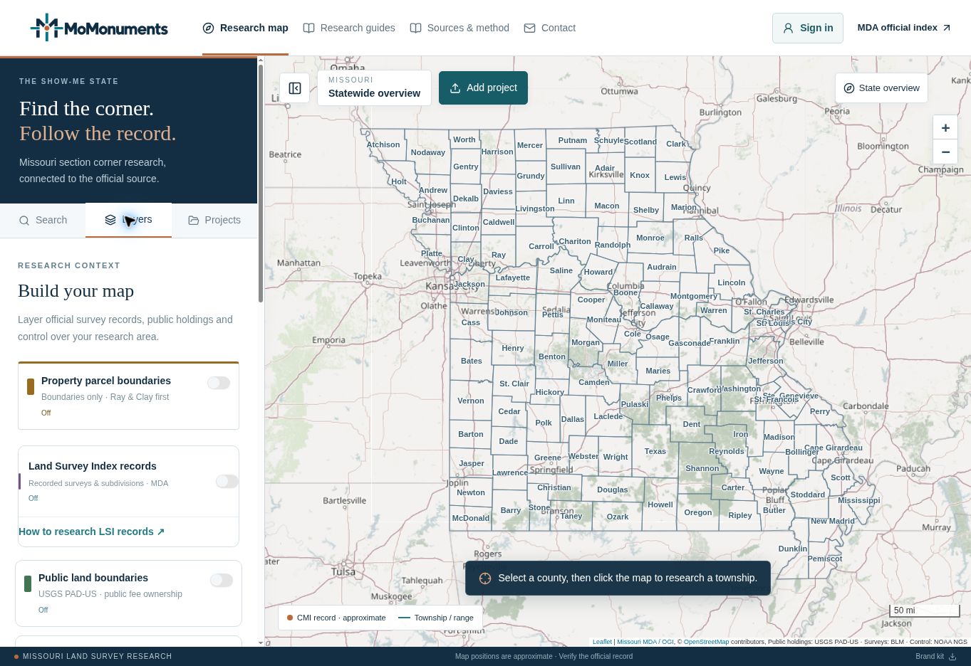
Open Research map and navigate to the project. For the worked example, use T52N · R29W. A regular corner-record search can help position the map, but LSI is queried separately when you select its township outline.
- 02
Open the Layers tab.
Turn on Land Survey Index records. The layer starts off on a new map unless you have saved a different account preference. Saved maps keep their layer settings.
- 03
Zoom closer if requested.
Township search outlines appear at zoom 7 and closer. Look for the dashed purple boundaries and the Search LSI township label when you hover over an area.
- 04
Select the township.
Click a purple township outline or its interior. Confirm T52N · R29W in the Land Survey Index panel and wait for the live index lookup. Each new township selection replaces the previous LSI lookup.
Understand the purple sections and counts
Dashed purple township outlines are areas you can search. They do not indicate that records have already been found. After a lookup, filled purple sections show where returned index entries reference standard sections. At closer zoom levels, the map labels these sections with their distinct-document counts.
A filled section locates a research reference. The app does not trace the boundary shown on each survey image, position individual monuments from that survey, or reduce the highlight to a fractional-section footprint. Read fraction and section-line codes in the record details and consult the original document.
Choose Show indexed sections on map to fit the returned section coverage. Then click a filled section to reopen the record panel with that section selected. Use All section references to return to the township’s full result list.
| What you see | What it means |
|---|---|
| Documents | Distinct state document IDs in the returned township search |
| Index entries | All returned references; a document can have more than one |
| S6 · 12 docs, for example | Twelve distinct returned documents reference section 6 |
| Entries without matched section geometry | Records retained in the list, including township-only or irregular references |
Filter and compare the survey records
- 01
Narrow the document list.
Use Filter survey records to search a document name, surveyor, subdivision or named survey, book/page, or US Survey reference. Use the section menu to focus on one section or township / irregular references.
- 02
Read the card’s references.
Compare the date, surveyor, book/page, named survey, section references, fraction codes, section-line codes and US Survey number. The original location code identifies the source location in Missouri’s index; it is not a map coordinate.
- 03
Inspect a preview when available.
View official image preview appears only when Missouri supplies a public preview link. A card without that button still has an index entry and can be researched through the state ordering workflow.
- 04
Keep the reference with the project.
Record the document name, book/page and legal reference in your project research notes. Use Show more survey documents to continue through a long result list.
Open the matching state record and download it
Select Find & order full record on the desired card. The MoMonuments dialog retains the document name and book/page and provides Copy search details. The LSI handoff searches by Document Name; compare the actual result row because one name can appear under several legal references.
- 01
Open Missouri search page.
This opens the state form in a new tab and starts the browser session Missouri needs. Wait until the state form has loaded.
- 02
Return to MoMonuments.
Come back to the original tab and select Open matching state results. The prepared request supplies the selected document name. Keep both steps in the same browser.
- 03
Match and select the record.
Check the document name, book/page and legal references in Missouri’s results. Select the desired checkbox, then choose Add to Cart. Review the cart for repeated entries before ordering.
- 04
Complete the state download.
Follow Missouri’s cart and checkout instructions, review its charges, then download and save the purchased document before leaving the state page. Retain the receipt and order number.
Recover from an error or incomplete result
The result panel shows when Missouri was queried. Responses may be briefly cached, and a new township lookup is not a claim of countywide or statewide completeness. Research adjacent townships and other repository sources when the legal description requires it.
| Situation | Next step |
|---|---|
| Land Survey Index Error Page | Repeat Open Missouri search page, wait for the form to load, then return and open the matching results. An expired or missing state session can cause this error. |
| Prepared results still fail | Use Copy search details and enter the Document Name directly in the official state form, then select Search. |
| Source unavailable | Retry survey lookup in the record panel. For failed township outlines, use Refresh visible layers in the Layers tab. |
| The state reports a result limit | Continue in the official index and narrow by section, surveyor or date. |
| No preview button | Use the full-record handoff; Missouri does not provide a public preview for every indexed document. |
| Records listed but no section fill | Keep the returned references. Geometry can be unavailable, or the entries may use township, section-line or irregular-survey references. |
Official sources
Continue with the agency responsible for the data or documents. Read MoMonuments data sources and methods for how these layers are used on the map.