
 View full size ↗
Read the reference from broad to specific
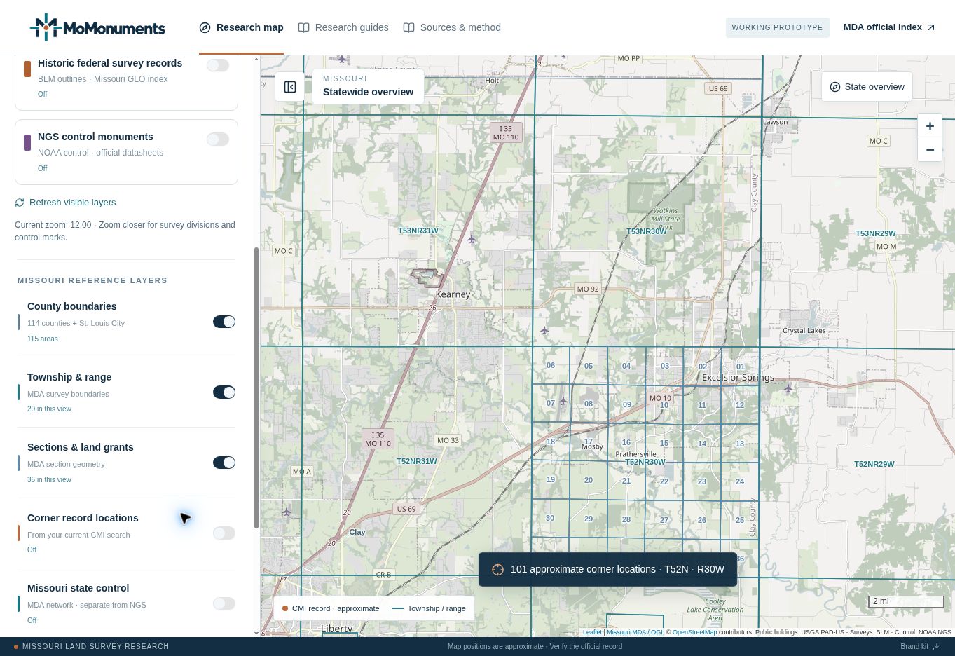
Missouri’s state index uses north townships and east or west ranges referenced to the Fifth Principal Meridian. In T52N · R30W, 52 identifies the township tier and 30 identifies the range west of that meridian.
A regular PLSS township is nominally six miles square, usually divided into 36 sections. Section numbers narrow the location within the township. Actual geometry can vary around corrections, irregular surveys, grants and water boundaries. Treat the diagrammatic grid as an orientation aid.
| Reference | What it tells you |
|---|---|
| T52N | Township 52 north |
| R30W | Range 30 west |
| Section number | A division within that township |
| CMI corner index | A position in Missouri’s letter/number index |
| Document number | A specific filing in the state repository |
Keep the corner index separate from the section number
Missouri publishes a letter/number corner grid. Use the official grid linked below to interpret the CMI designation; entering a section number as a corner reference is not an equivalent search.
In MoMonuments, the result row names the corner index and the record panel names the document. Preserve both in your notes along with the township and range. The same short corner designation can recur in many townships.
Use the map to check your orientation
- 01
Run the township example.
Open T52N · R30W and compare the search label with your intended reference.
- 02
Open Map layers.
Under Missouri reference layers, keep Township & range and Sections & land grants enabled. Zoom closer when a layer asks you to.
- 03
Compare adjoining areas.
Look at the township edges and adjoining sections before interpreting a boundary-corner filing. Search neighboring townships separately when appropriate.
- 04
Verify the document.
Confirm the legal description and actual corner designation in the original filing. Map labels alone do not establish which corner a surveyor documented.
Allow for irregular surveys and grants
Some Missouri research will not fit a simple township grid. MoMonuments provides a US Survey number search and a Historic federal survey records layer for additional context. Those are separate searches, not automatic replacements for the legal description.
The historic layer only sends supported whole north-township references to Missouri’s GLO index. When the reference is unsupported or unavailable, use the source identifiers and the official federal portal. Keep the original wording of the description in your research notes.
Official sources
Continue with the agency responsible for the data or documents. Read MoMonuments data sources and methods for how these layers are used on the map.